
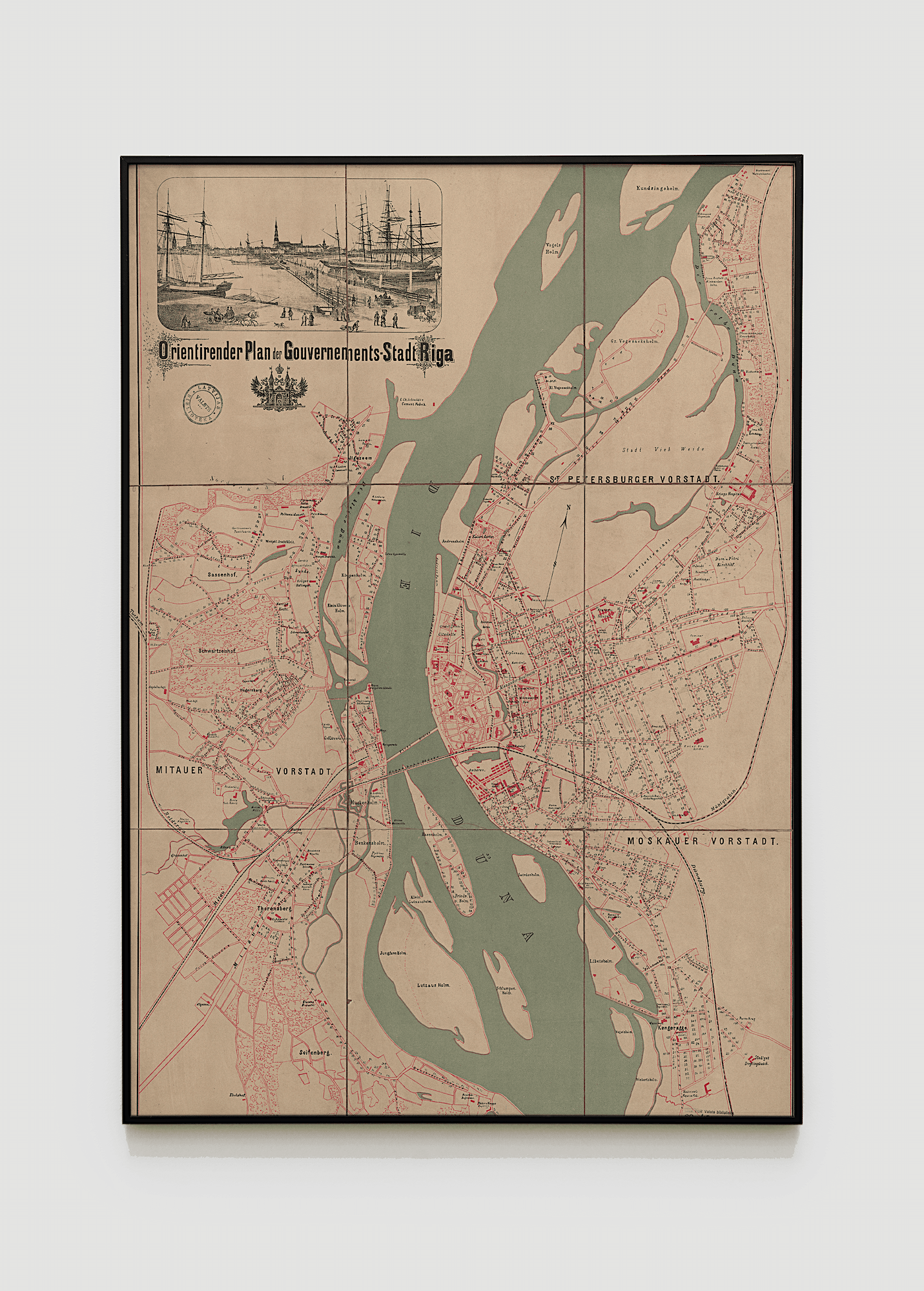
For some, this place reminds only of the Mūkusalas Street, which runs next to this area, others refer to it as the Mūkusala neighbourhood, but others regard it as a continuation of the Torņakalns neighbourhood. Since the end of last year, this place has been named MŪKU SALA (translation from Latvian – Monk Island), which is not simply a place, but a whole community with its own vision and plans for the future. But there is no future without the past – before building grand projects for the future, we need to look back let ourselves be inspired by the rich history of this place.
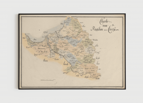
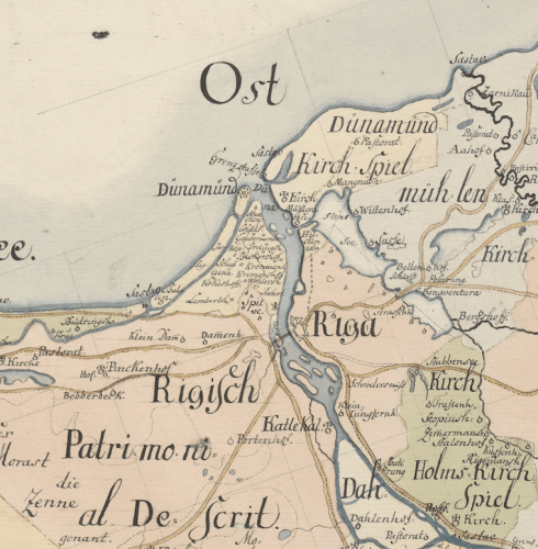
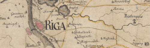
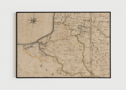
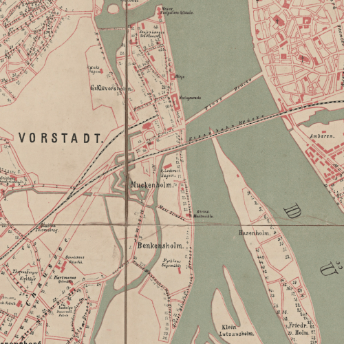
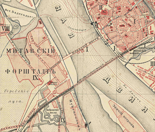
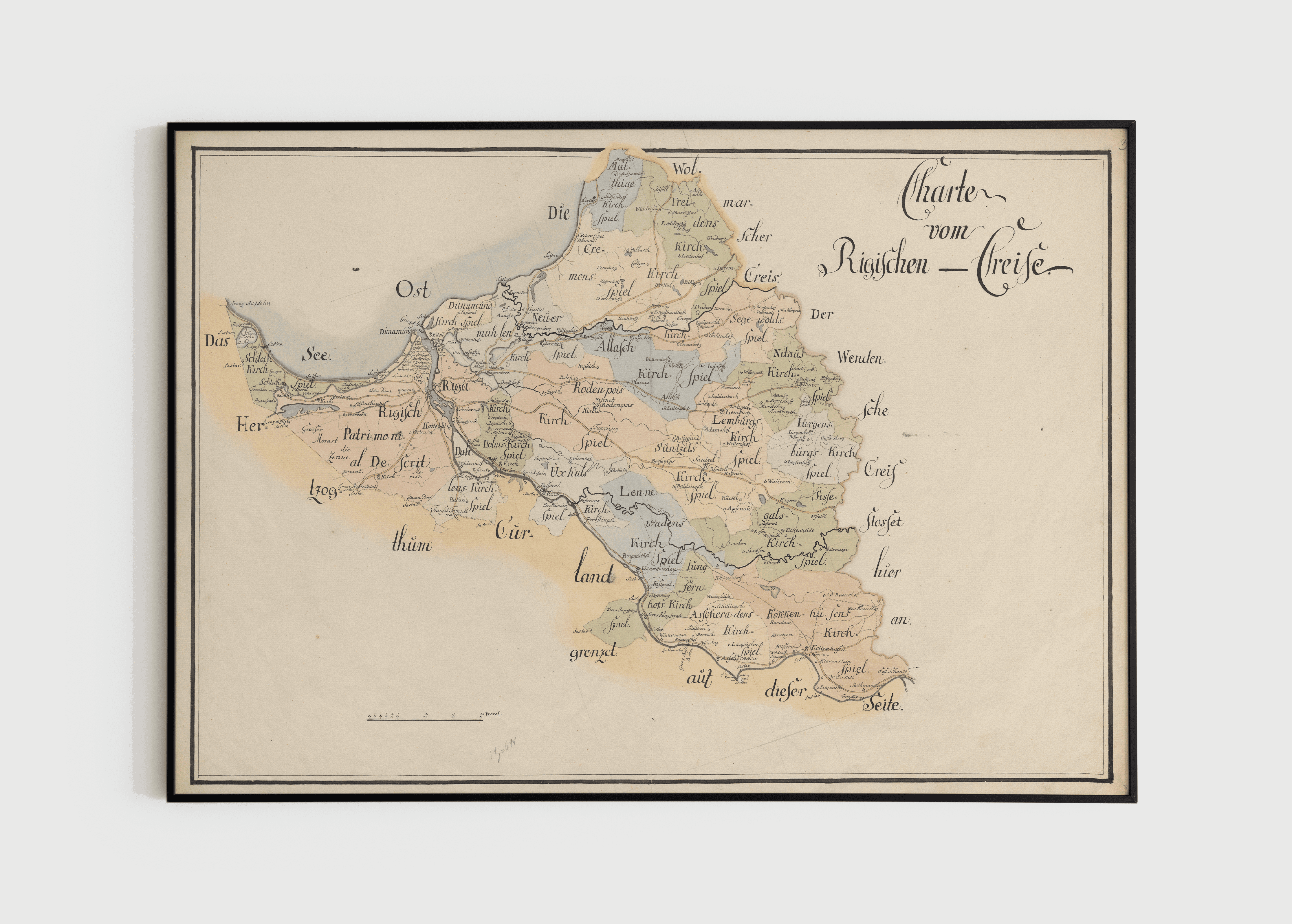
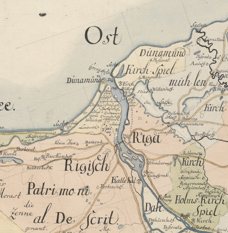
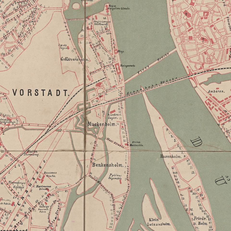
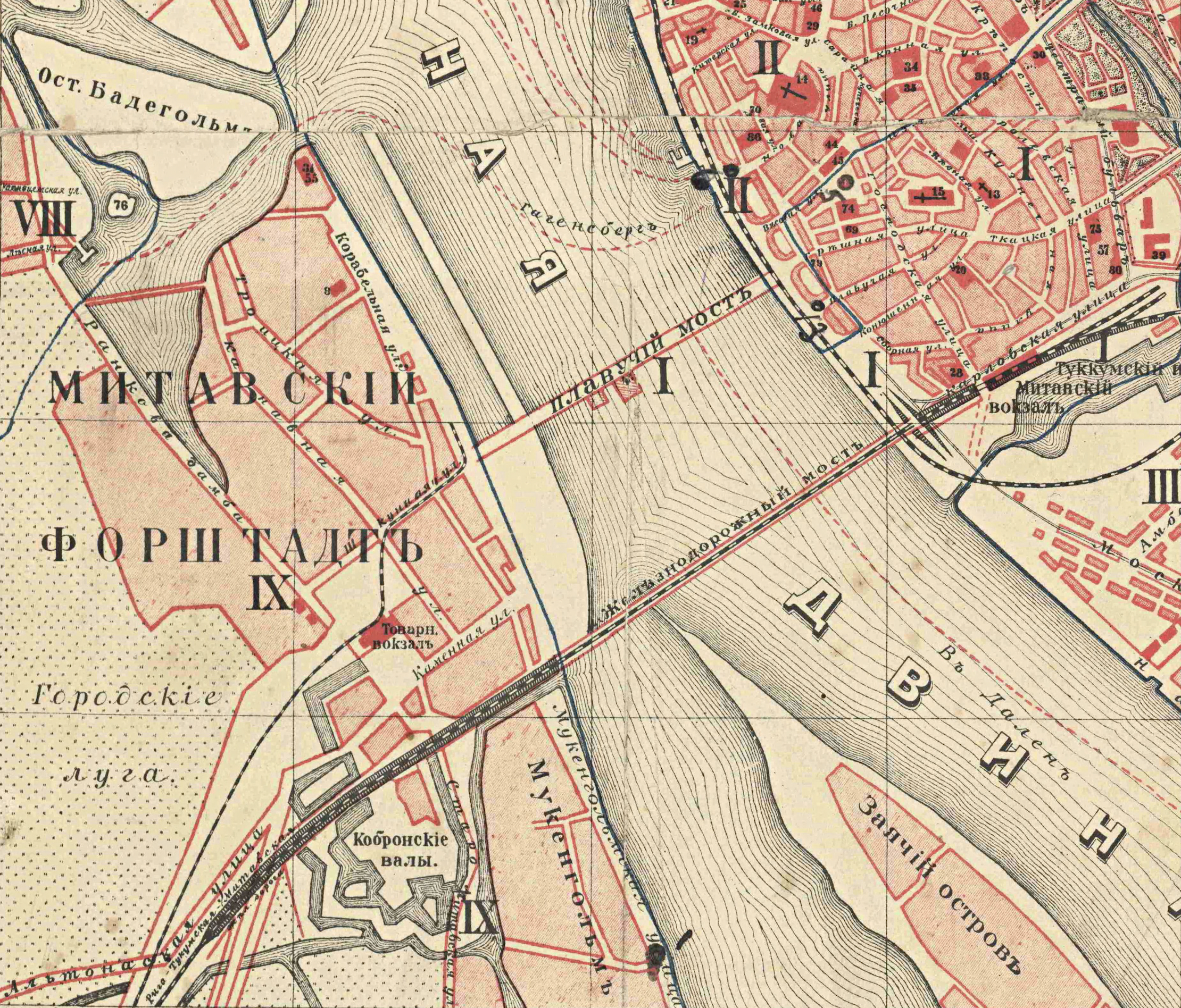
Nowadays, Mūkusala (Monk Island) can no longer be called an island – it has merged with the area of Torņakalns (translation from Latvian – Tower Hill) and the left bank of Daugava, but the fact that this place has really been an island until relatively recently is revealed not only by the name itself, but also by a small partially filled ditch or canal – Kīleveina ditch (also called the Tower Ditch or the Mast Ditch in historical sources), which was once a tributary that separated the island from the left bank of the Daugava river. Nowadays, there is nothing that would sagest that Bieķensala and Mūkusala were once separate islands. Over time, the two islands have merged and become a single territory – the two islands were once separated in the place where Dēļu Street is currently located.
Signs have also been found that suggest that the territory of Mūkusala was inhabited long before the founding of Riga itself – in the 1923 edition of “Latvijas saule” (The Latvian Sun) in an article by Eduards Bratiša (who, incidentally, is the founder of the Dievturība neopagan movement – a monument dedicated to him can be found in Kronvalda Park) it is mentioned that an ancient brooch, dated around 6th-8th century, was found in Mūkusala, near the Daugava. Which means that this brooch is at least five centuries older than Riga itself.
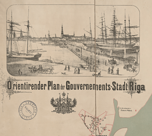
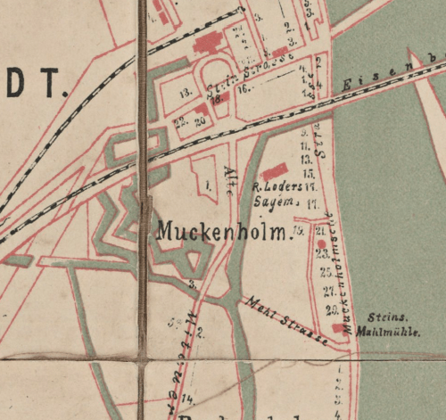
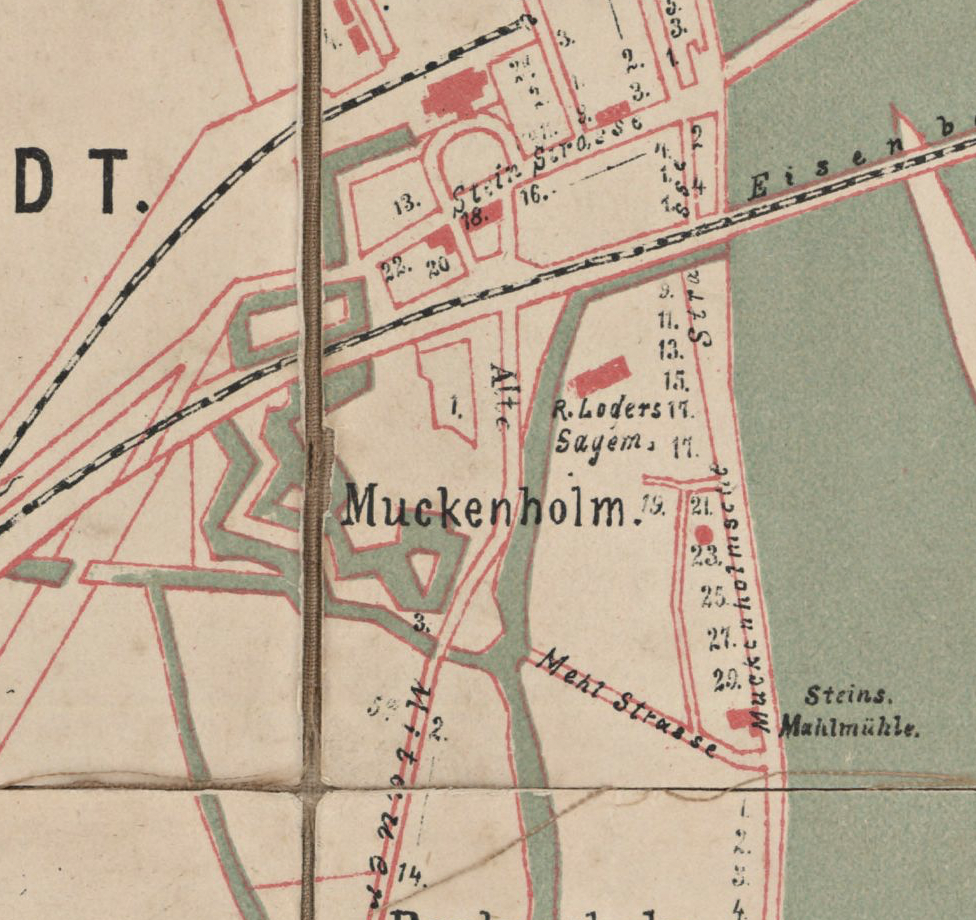
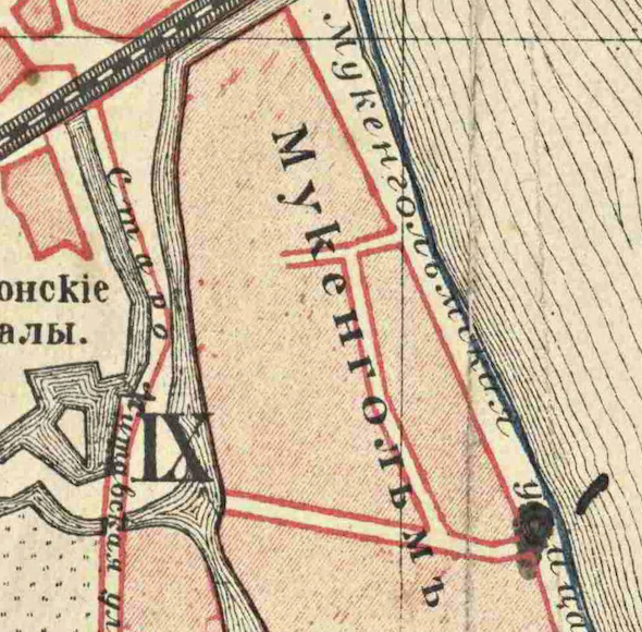
In 2021, when creating the brand MŪKU SALA with the aim to unite the area around Mūkusalas Street, one of the earliest reference points in the known history of this place served as a source of inspiration – Mūkusala got its name due to the Cistercian nunnery, to which this territory belonged since 1275. As customary in the history of Latvia, the origins of the name of this place can be traced back to the German language – in honour of the Cistercian sisters, the island got the name Muckenholm – the monastery island. The name “Mūkusala” in Latvian has developed over time as an indirect translation.
Contrary to the fact that the name might indicate that the monastery was located in Mūkusala, it in fact was located next to the current church of St. Mary Magdalene in Riga, that is, in modern Old Riga. What was the fate of this monastery? During the Reformation (16th century), all monasteries were destroyed, and their property handed over to non-religious entities, but this monastery was allowed to disappear on its own, forbidding the admission of new sisters. This kindness was shown to it because the Cistercian nuns were highly respected in the city.
Materials of Latvian State Historical Archive
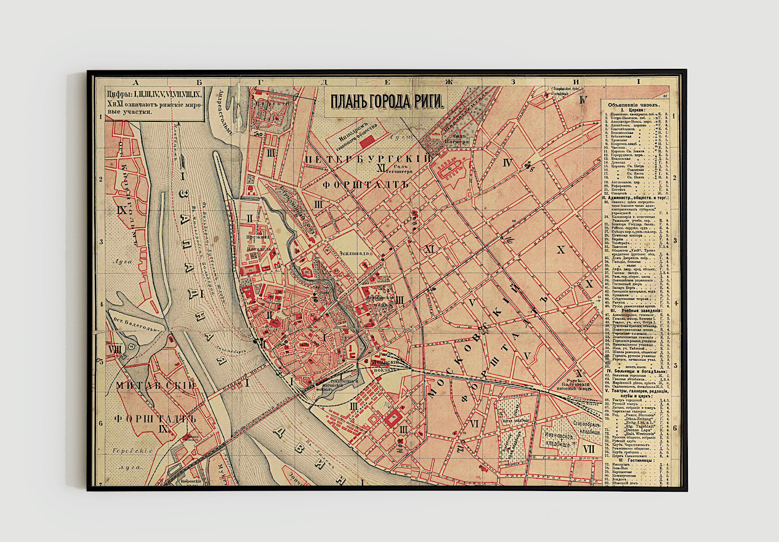
One advantage of the Mūkusala neighbourhood has remained the same over time – its location. These days, the priorities of people are different – as few traffic jams as possible, proximity to the city centre, availability of services… However, historically, the significance of the territory has been characterized by its usefulness in the event of war. And the surroundings of Mūkusala have been used for various types of military fortifications almost since the birth of Riga even until the 19th century.
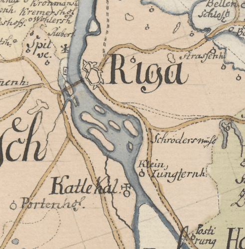
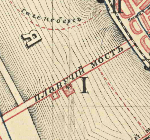
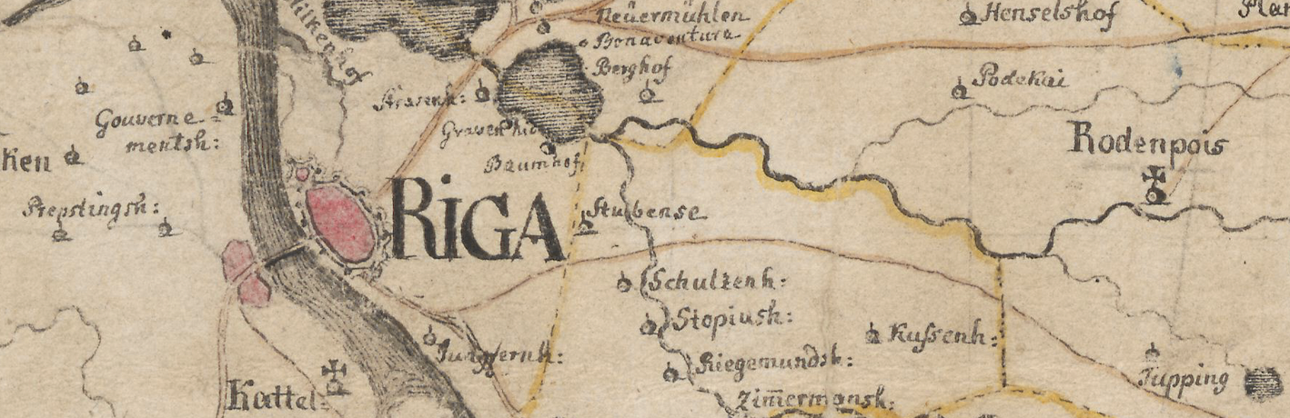
Around 1226, near Mūkusala, Mārupīte river was blocked, and the Riga bishop’s mill was built. During this time, the Crusaders used the watermill not only as an economic object, but also as a fortress. Around the same time, right in front of Mūkusala, the Livonian Order built a high watchtower, which allowed it to watch the movement in the direction of the river ferry from afar. Its name has changed several times over the years, but in the 18th century it was called the “Red Tower”. It is believed that it was located near the place where the Academic Centre of the University of Latvia is currently located, but as the banks of the Daugava have changed, it is no longer possible to find this place. It is believed that it was this tower that gave the name to the neighbourhood of Torņakalns.
During the siege of Riga, which belonged to Poland in the 17th century, Swedish troops built several fortifications and trenches here, all of which collapsed over time, but one of them survived as it was the only one to be completed. It has gone down in history as Kobronskansts, and over time it was reconstructed and fortified several times, most recently before the war in 1812 (also known as Napoleon’s Russian campaign). The remains of Kobronskansts were discovered during the construction of the Academic Centre of the University of Latvia.
Materials of Latvian State Historical Archive
Today, our lives are fast paced, but much more predictable than in historic times. Of course, we occasionally face inconveniences such as poorly cleaned streets in the winter or the recurrent restrictions of a pandemic, but this is in no way comparable to the annual worries faced by the people of Mūkusala long after they had settled there.
Around the 17th century, the islands were mainly inhabited by fishermen and ferrymen. Despite the changing powers and armies that have desired Riga time after time, the inhabitants of Mūkusala have been mainly Latvians. However, until the 18th century, life here was relatively unpredictable – although in peacetime the people grew cabbage and grazed cows here, and during the war they protected fortifications from the invaders, the main threat has always been mother nature itself.
From 1764 to 1782, a chain of dams was built along the Daugava, which finally protected the islanders from annual floods. Until then, the inhabitants of the island could never be sure that the vegetable gardens, sheds, and even residential buildings would not be demolished by flood ice and dragged into the Gulf of Riga. Historical sources tell stories about the inhabitants of Riga’s “inner city”, who crowded along high ramparts, which surrounded the city during the floods, to watch from a safe distance how whole houses and even cows stuck out on the ice were being pulled into the sea. Despite all this, the inhabitants of Mūkusala have always been thick-skinned, because the population growth was not stopped by these difficulties.
It was with the construction of the dams that Mūkusala and Bieķensala merged into a single territory, and both together – with the left bank of the Daugava. This is the story of how Mūkusala stopped being an island.
Materials of Latvian State Historical Archive
Many believe that the area of the present Mūkusalas Street became an industrial area only in the 20th century, but in fact this place has been associated with hard work a long time before that – people here have been involved not only in production, but also in fishing, agriculture, and the transit of various goods (and people).
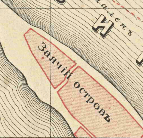
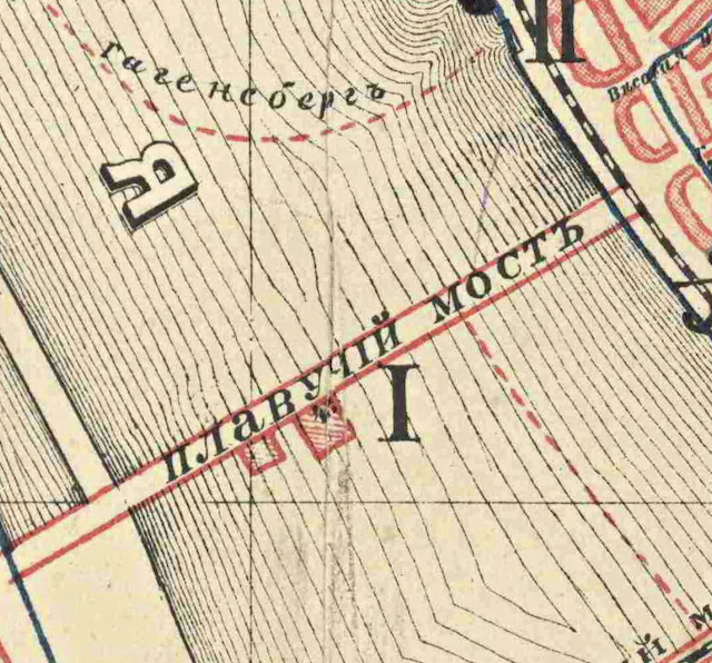
Only a few hundred years ago, both banks of the Daugava relied on boats as the main mode of transportation, but starting from the 18th century, both shores of Riga were connected by the Floating Bridge (the predecessor of the Pontoon Bridge, which replaced the Floating Bridge in the 19th century). The bridge started between Grēcinieku and Peldu Streets on the right bank of the Daugava, stretched to Zaķusala, while the end of the bridge on the left bank was located in Mūkusala (yes, the bridge was not perpendicular to the current). Over time, the end point of the bridge on the left bank was moved to Klīversala to “straighten” then bridge.
Prior to the introduction of a developed railway network, river routes played an important role – the most popular goods exported through Riga were flax, hemp, linseed, grain, and timber. The water route along the Daugava was extremely important in the delivery of timber to Riga, because apart from the insignificant amount of firewood, for the transport of which it was convenient to use animal transport, it was advantageous to transport the timber only by water.
The timber trade was highly profitable not only for timber traders but also for sawmill owners. It is known from historical sources that at least one of these sawmills was located in Mūkusala at the end of the 18th century and in 1764 belonged to the member of the Riga Small Guild, the miller Kīleveins. In 1821, the Mūkusala sawmill was purchased by Teodors Šrēders, who set up an oil press instead. Over time, this facility has also lost its relevance, as the world had begun to prefer the fat of whales and other marine animals over oil.
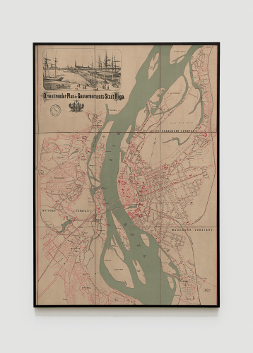
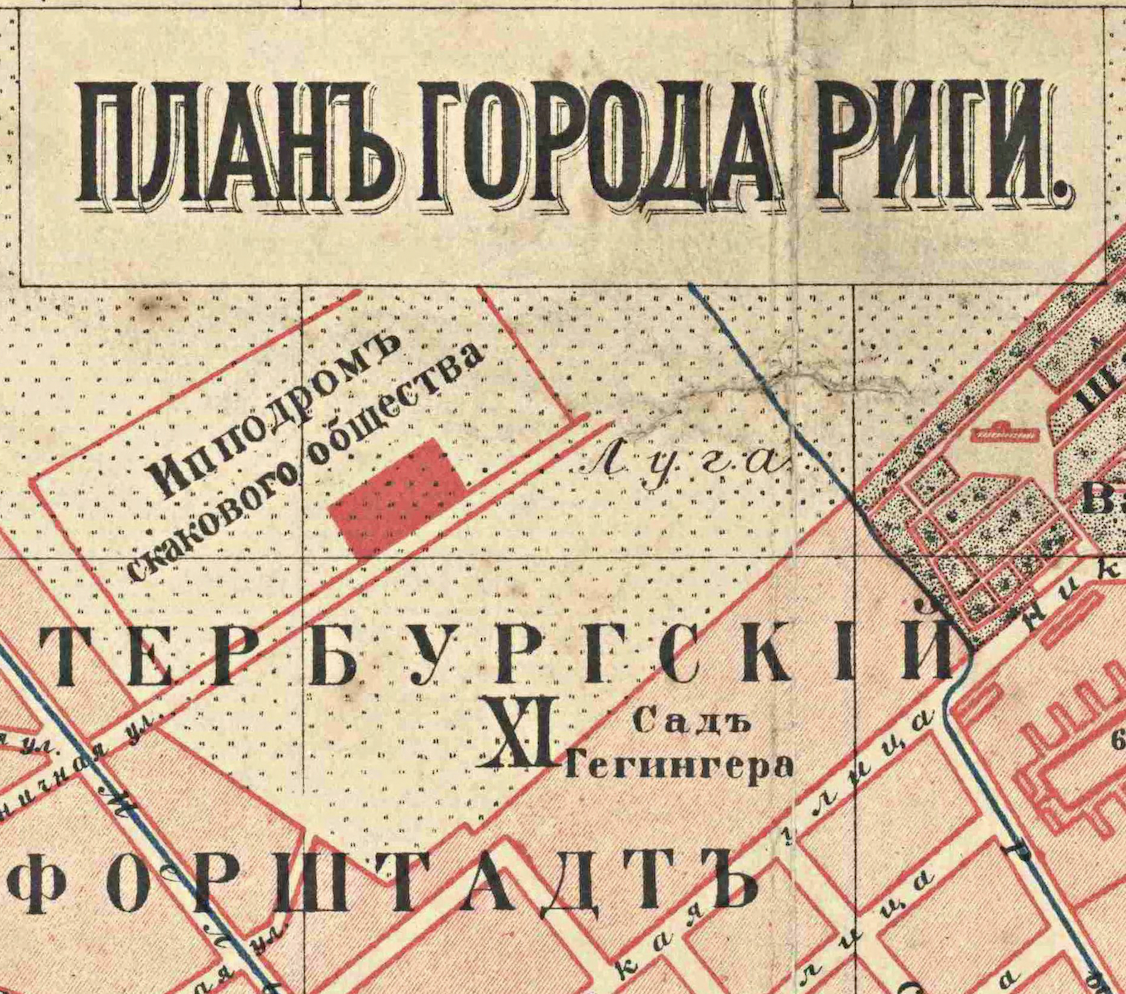
In the second half of the 19th century, the streets of Riga began to be lit with gas lamps, and over time, the question of creating a lighting network on the left bank of Riga arose. For this purpose, a gas station was built in Mūkusala in 1872. On the maps dated around the end of 19th century, several steam mills in Mūkusala are also marked.
Materials of Latvian State Historical Archive
Looking back, it is clear why Mūkusala has become an industrial territory over time – its fate has been largely dictated by the proximity of water transport, import and export trends, as well as the fluctuating political situation since the very founding of Riga. It is therefore clear that the industrial development of the 20th century in this area is only a logical continuation of events.
At the end of the 19th century, its own infrastructure had developed here: baths, border barracks, a rescue station, a connection to the right bank of the river and a plethora of various factories. One of the most important production facilities in Mūkusala – Karl Zeiss optical factory – started operating in the very beginning of the 20th century – in 1912. The factory was created in response to St. Petersburg’s policy at the time – an increase in duties on imports of precision optics to ensure that domestic production began. Therefore, Zeiss sent almost all the parts to the Riga branch in Mūkusala from the main production plant –the final product itself was only put together in Riga.
At the beginning of the First World War, the property of the factory was deported – the Riga factory was evacuated, while all the equipment of the Zeiss factory was removed and transported to Russia, where it is allegedly still being used today.
In the interwar period, the most important production plant in Mūkusala was the M. Kalniņš chemical plant, which mainly specialized in the production of paints and detergents. The company Radiotehnika (RRR), which was later taken over by the company VEF Radiotehnika RRR, also played an important role here. The radio engineering factory was located here since 1927 and in its honour the current Mūkusalas Street was once called Radiotehnikas Street. In addition to these factories, after the Second World War, a concrete factory, and a bakery (which eventually became part of the production association “Druva”), as well as a plastic products factory “Ausma” were located here.
Diversity seems to have always been one of the keywords that best describe this area.
And here we are – in the 21st century, this area continues to flourish and evolve with the times. But one thing is clear – history is still revered here, even as the historical features of Mūkusala become increasingly difficult to see. Now we call this place MŪKU SALA, and, as always, it is a place for productive work, it is a place that has always kept up with the times. It is a place where history was always created.

